Jamaicans take shelter as hurricane intensifies to Category 5
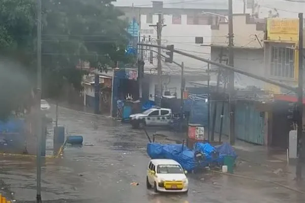
Stockholm, October 28 (Hibya) – Jamaicans began moving into shelters as Hurricane Melissa, now a Category 5 storm, approached the coast amid warnings of catastrophic flooding, landslides, and severe damage to infrastructure.
The massive, slow-moving hurricane — the strongest to hit Jamaica since records began in 1851 — is expected to make landfall early Tuesday and remain over the island for some time.
According to meteorologists, the storm is expected to cross the island diagonally, entering from the south near the St. Elizabeth region and exiting to the north near St. Ann.
Late Monday, the storm was located about 240 kilometers southwest of Kingston and 530 kilometers southwest of Guantanamo, Cuba, with maximum sustained winds of 280 km/h. According to the U.S. National Hurricane Center in Miami, the storm was moving north-northeast at 4 km/h.
The U.S. National Hurricane Center said parts of eastern Jamaica could receive up to one meter of rainfall, while western Haiti could see up to 40 centimeters. Catastrophic flash flooding and numerous landslides are likely.
Prime Minister Andrew Holness stated, “There is no infrastructure in the region that can withstand a Category 5 hurricane. The question now is how fast we can recover. That is the real challenge.”
British News Agency
 Facebook
 Tweeter
 Whatsapp